Coastal Hazard Risk Management and Adaptation Planning – Horrocks Beach

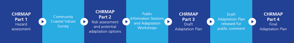
The Shire of Northampton is currently in the process of preparing a Coastal Hazard Risk Management and Adaptation Plan (CHRMAP) for Horrocks Beach. The CHRMAP will be a strategic planning document that:
- informs community and decision makers about potential current and future coastal hazards (such as erosion and inundation) at Horrocks, including the effects of predicted sea level rise;
- identifies the risk level that those hazards pose; and
- recommends proposed management and adaptation responses to address the identified risks.
The preparation of the CHRMAP will also seek to identify the natural and community coastal values values of our community and adopt or consider those values when developing the recommended actions of the CHRMAP.
The initial community consultation and values survey are expected to take place in early 2019 and the whole project is expected to take around 18 months to complete.
Once finalised, the CHRMAP will be used to guide necessary changes to the Shire’s Local Planning Strategy, Local Planning Scheme and other relevant strategies and local planning policies, for the sustainable land use and planning of Horrocks.
How can I get involved?
Community engagement and involvement will be a very important part of the CHRMAP process and we encourage everyone who has an interest in the future of Horrocks to get involved! Coastal management is a continuous process which requires community input and involvement. To register your interest and be added to the Horrocks CHRMAP mailing list, click on the blue box below. We will then send you information regarding our surveys and events as and when they occur.

Want more information about CHRMAPs or the State Planning Policy for Coastal Planning?
To learn more about Coastal Hazard Risk Management and Adaptation Plans, click here.